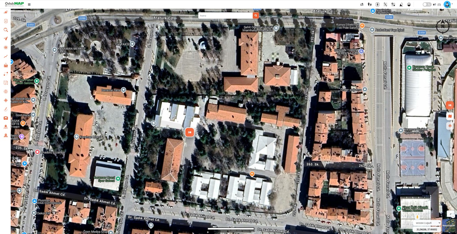
From 2D Map to 3D Scene
Direct transition from the work area on the satellite map to its corresponding 3D scene.



THE OPERATIONAL 3D ERA
3D data display is over, this is not 3D for presentation. Operational 3D begins: manage your processes in three dimensions.
OverviewExplore
2D-3D integration, 3D information queries, measurement tools, data linking and big data performance operate within a single structure.
Overview
OdakTwin is a 3D GIS platform that works in connection with 2D map data and brings the Digital Twin into your operations through object information queries, measurement and big data management.
Capabilities
Core Competencies
A 3D GIS platform that works in connection with 2D map data and brings the Digital Twin into your operations through object information queries, measurement and big data management.
Go to OverviewA transition is made to a 3D scene that works in integration with the 2D map. Selections on the map appear in the 3D scene, and selections in the 3D scene are instantly shown on the 2D map.
By clicking objects in the 3D scene, parcel, building, numbering and related institutional data are accessed instantly.
Metadata and plan information for the selected 3D object are displayed within the scene.
Measurements such as length, area and height are performed quickly and precisely in the 3D environment.
3D building models are strongly linked to parcel, building, MAKS/numbering and other institutional data.
CityGML, 3D Tiles and LiDAR point cloud data are managed with high performance using layer logic and made queryable.
Capability Cards
The main capabilities of OdakTwin are organized as institutional summary cards.
A transition is made to a 3D scene that works in integration with the 2D map. Selections on the map appear in the 3D scene, and selections in the 3D scene are instantly shown on the 2D map. The system detects the 3D data within the map's visible area using bounding-box/extent information and routes the user directly to the relevant 3D model.
By clicking objects in the 3D scene, parcel, building, numbering and related institutional data are accessed instantly.
Metadata and plan information for the selected 3D object are displayed within the scene.
Measurements such as length, area and height are performed quickly and precisely in the 3D environment.
3D building models are strongly linked to parcel, building, MAKS/numbering and other institutional data.
CityGML, 3D Tiles and LiDAR point cloud data are managed with high performance using layer logic and made queryable according to institutional needs.
Resources
Explore the operational 3D capabilities of OdakTwin through the product presentation and introduction video.
An institutional product presentation covering operational 3D, digital twin and big data capabilities.
Open PresentationA hands-on demonstration of 2D-3D transition, object query and 3D measurement capabilities.
Watch VideoScreenshots
Selected screens from OdakTwin's core 3D workflows, analysis tools, and scene-editing capabilities.
2D-3D transition, measurement, LiDAR, metadata, and city-scale model management.
Direct transition from the work area on the satellite map to its corresponding 3D scene.
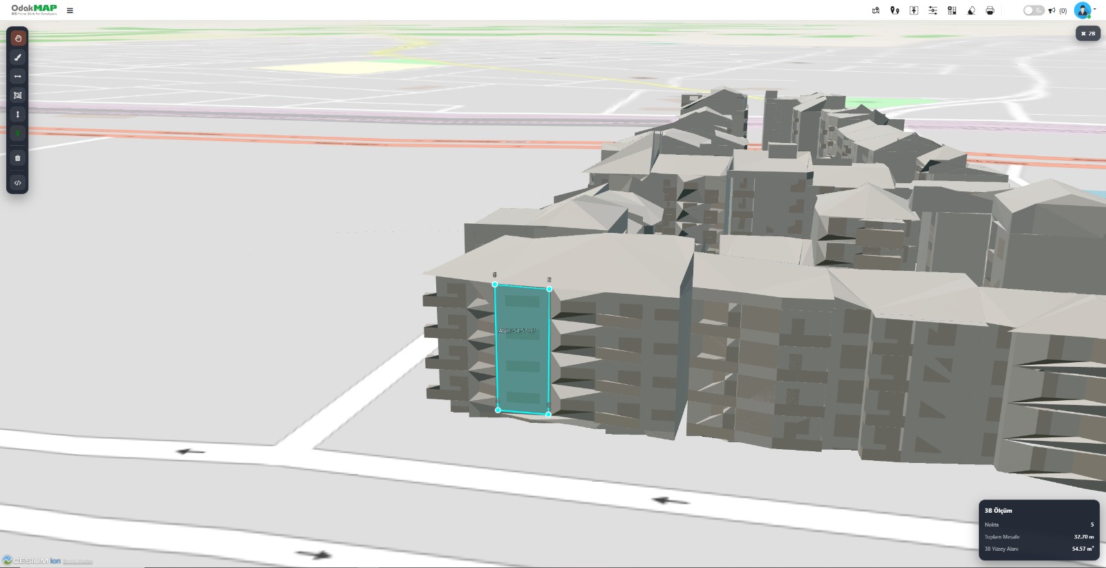
Combined display of point, distance, and surface-area measurements on a building facade.
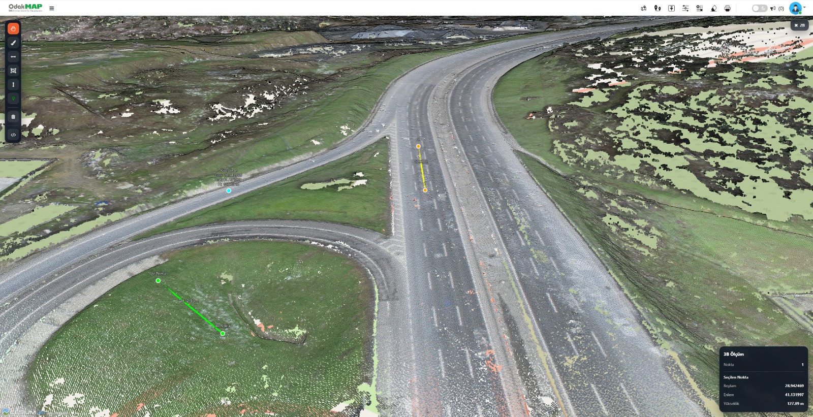
Field verification of coordinates, lengths, and areas directly on point-cloud data.
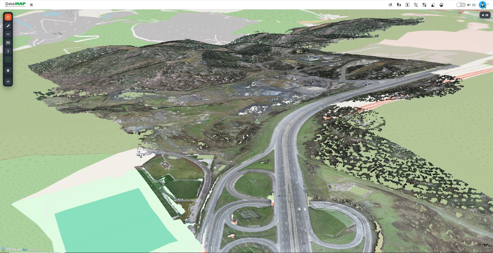
Large-scale inspection of terrain, road networks, and environmental details as a point cloud.
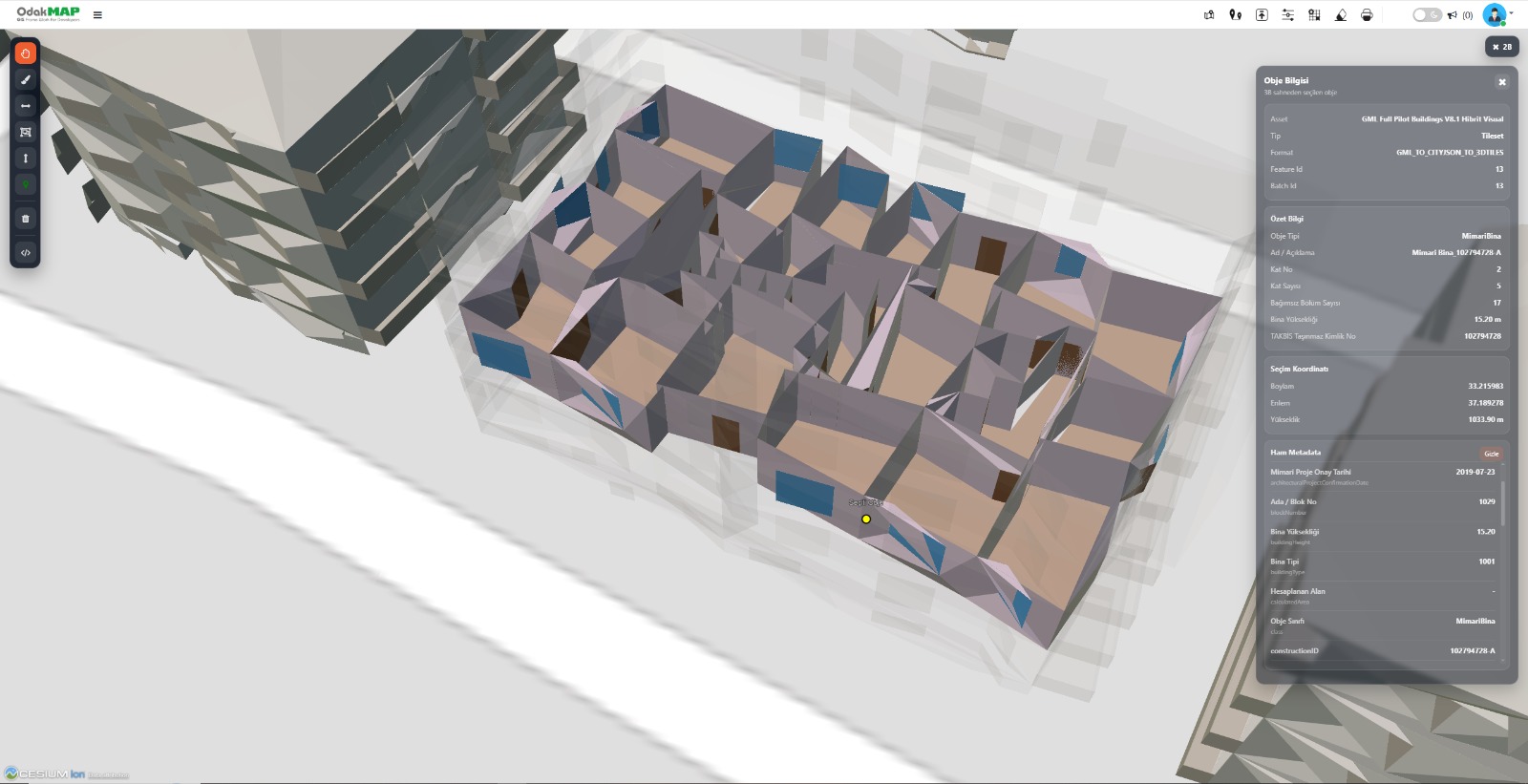
View floor, height, class, identifier, and raw metadata for the selected building.
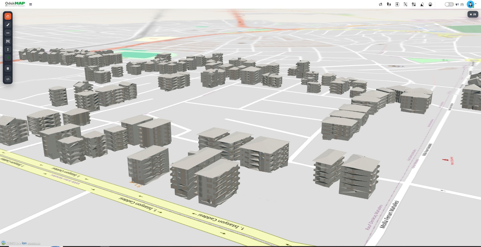
High-performance presentation of numerous building models over the map base.
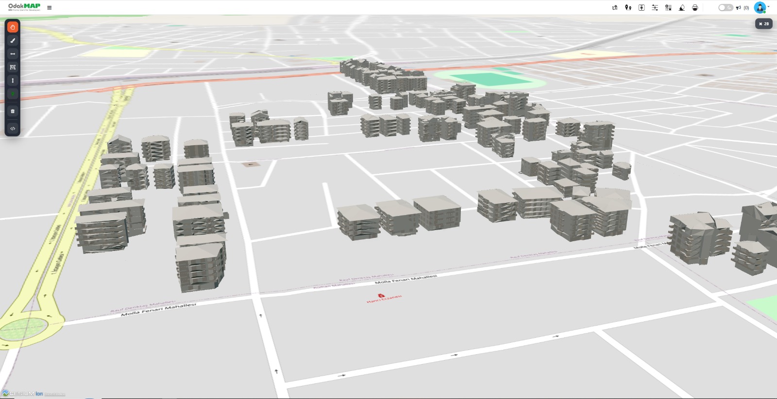
Spatial alignment of the urban 3D inventory with road and neighborhood data.
Shadow, night mode, wind, environmental analysis, statistics, and data-driven coloring.
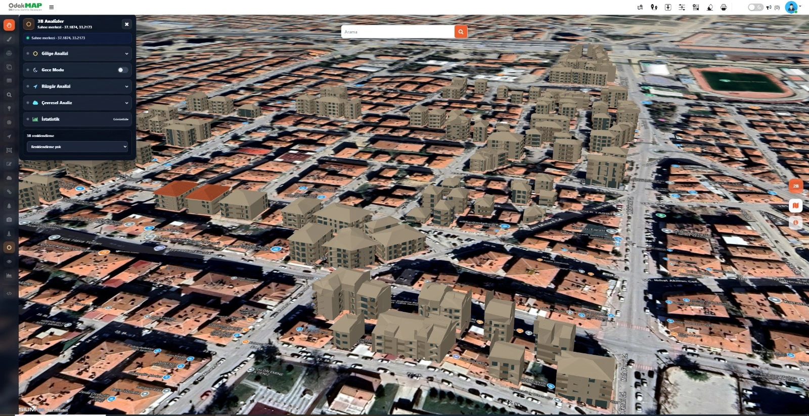
Access shadow, night mode, wind, environmental analysis, statistics, and coloring tools from one panel.
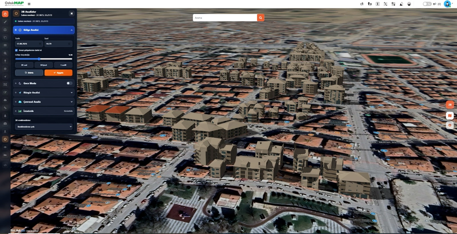
Examine shadows cast by buildings using date, time, and shadow-density controls.
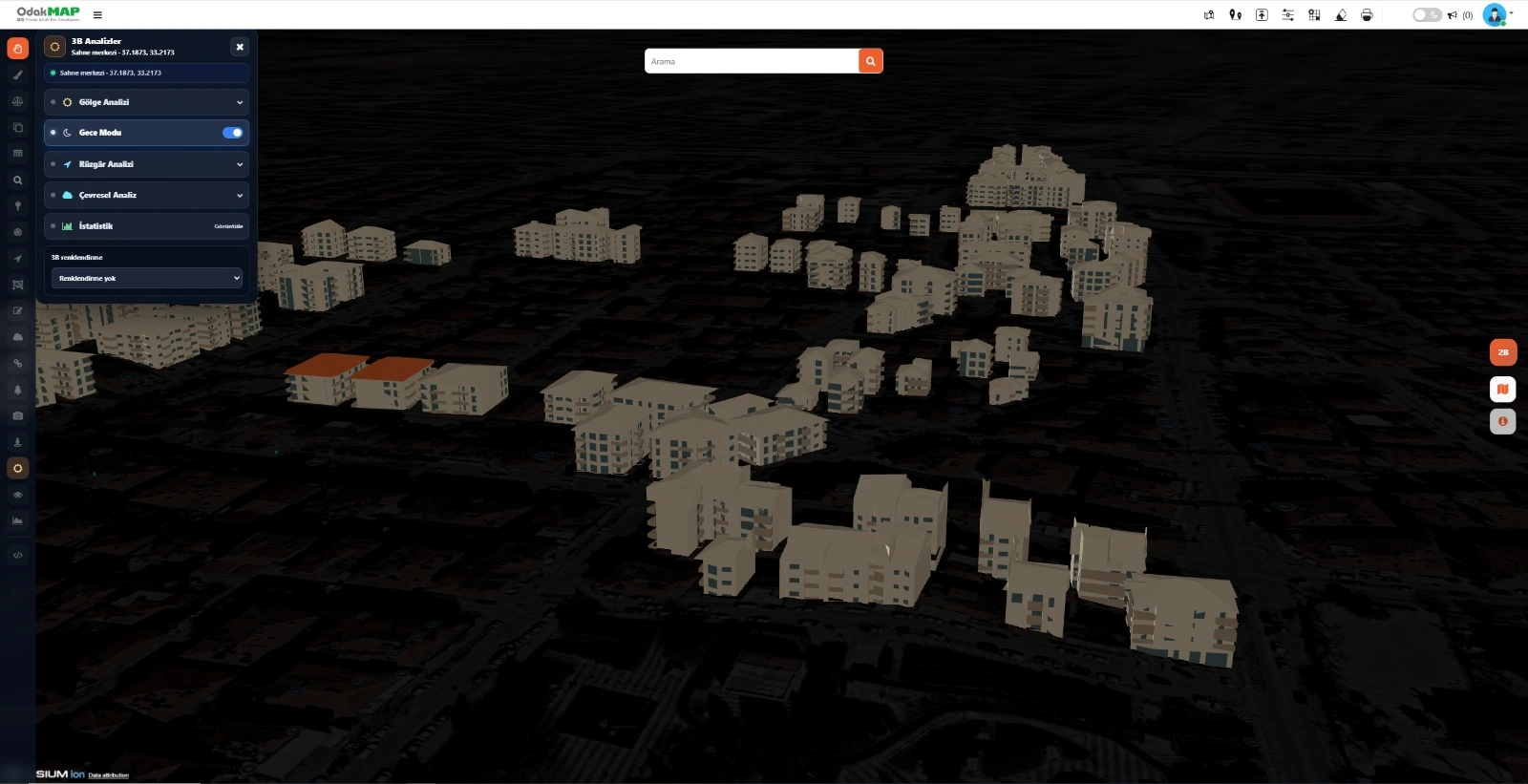
Evaluate the urban 3D scene in a nighttime view under low-light conditions.
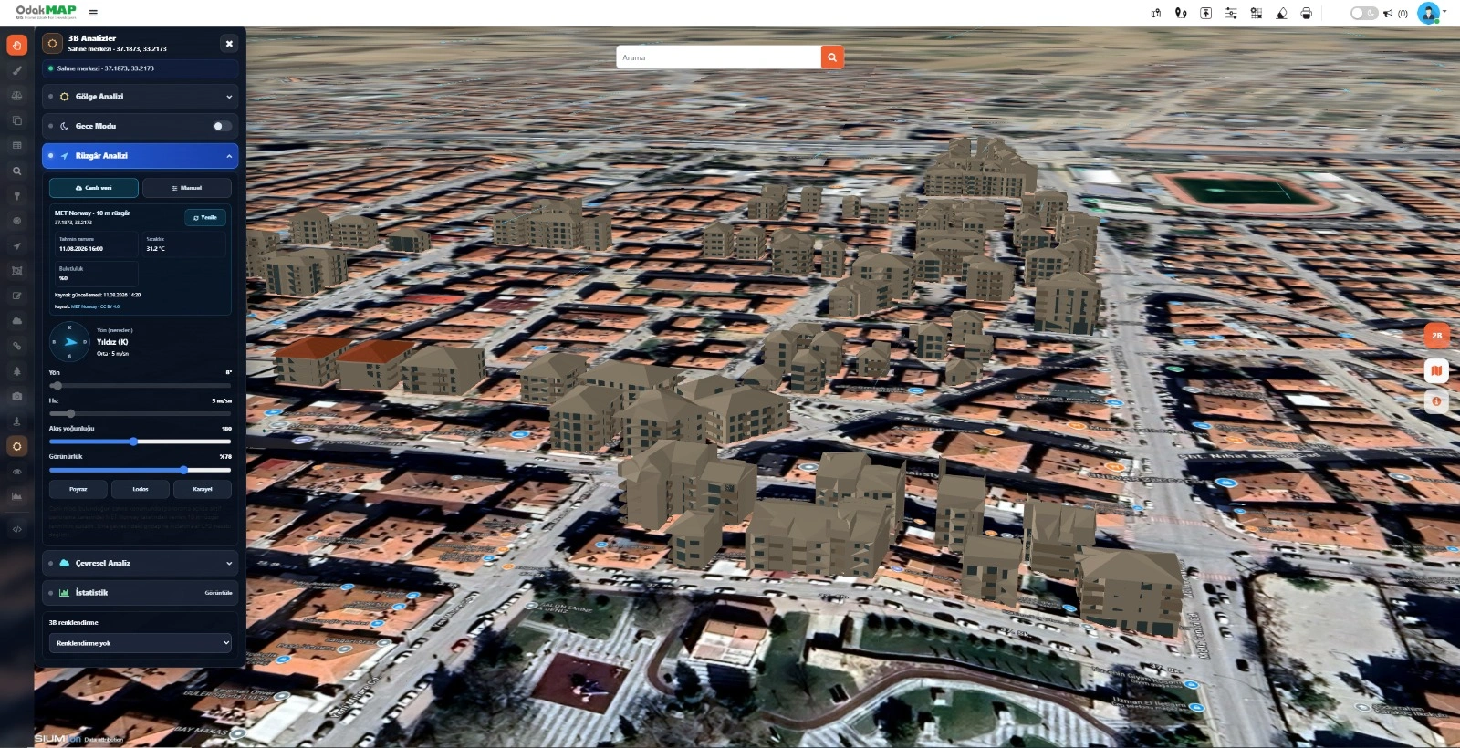
Display wind direction, speed, and flow density from a live meteorological source in the 3D scene.
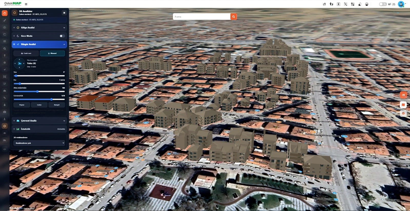
Let users define wind direction, speed, flow density, and visibility values.
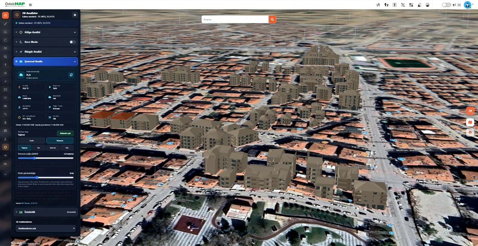
Simulate rain intensity and effect visibility in the 3D scene using live meteorological information.
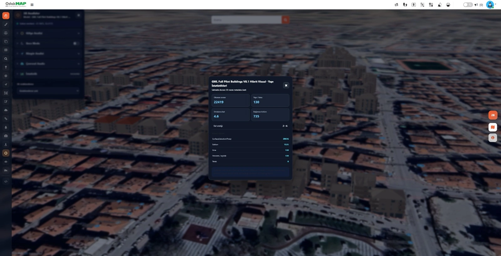
Present building count, average floors, independent units, and object types as summary statistics.
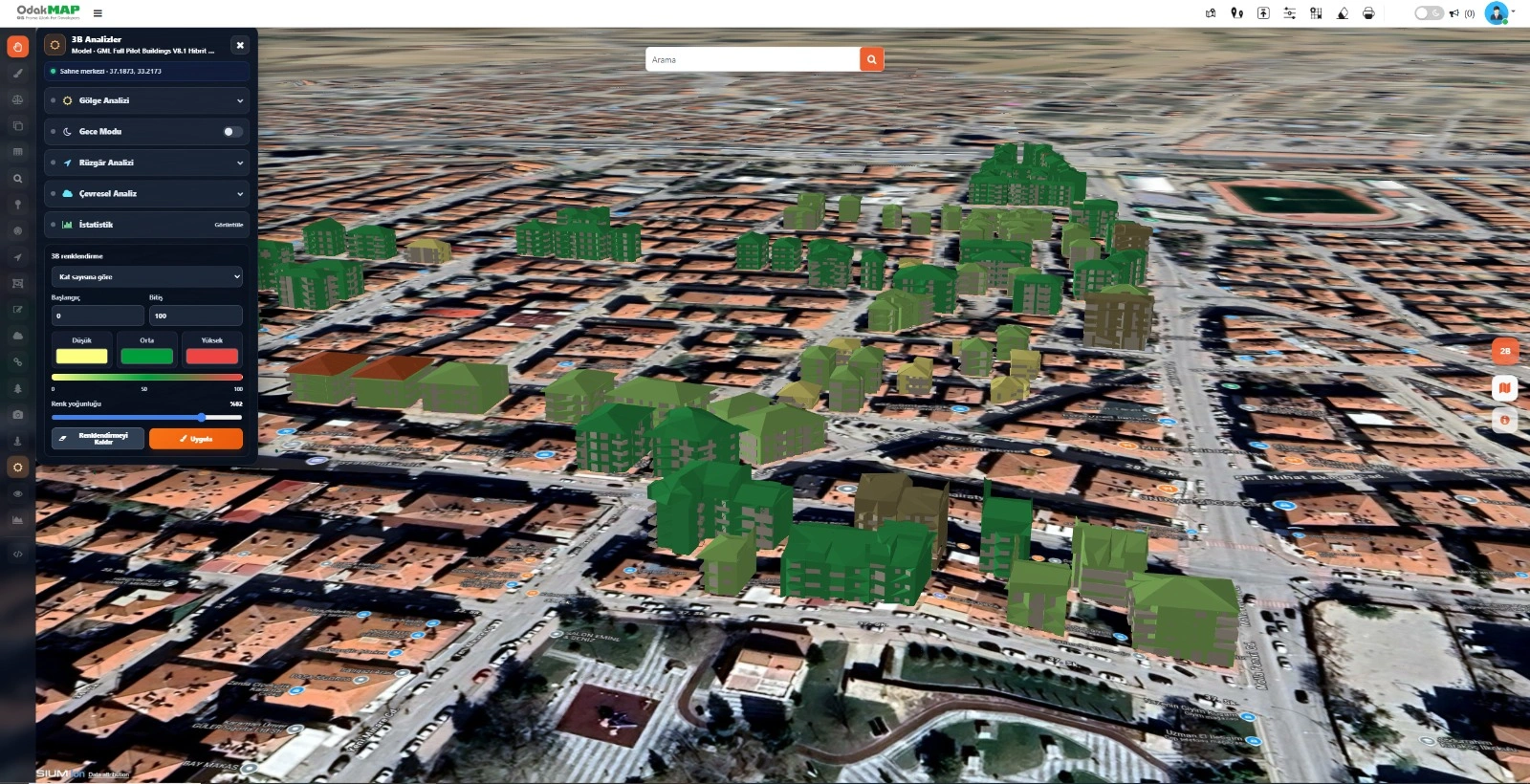
Apply thematic colors to buildings according to floor count, height, object type, or other data fields.
Texturing, street furniture, panoramic imagery, and areal visibility workflows.
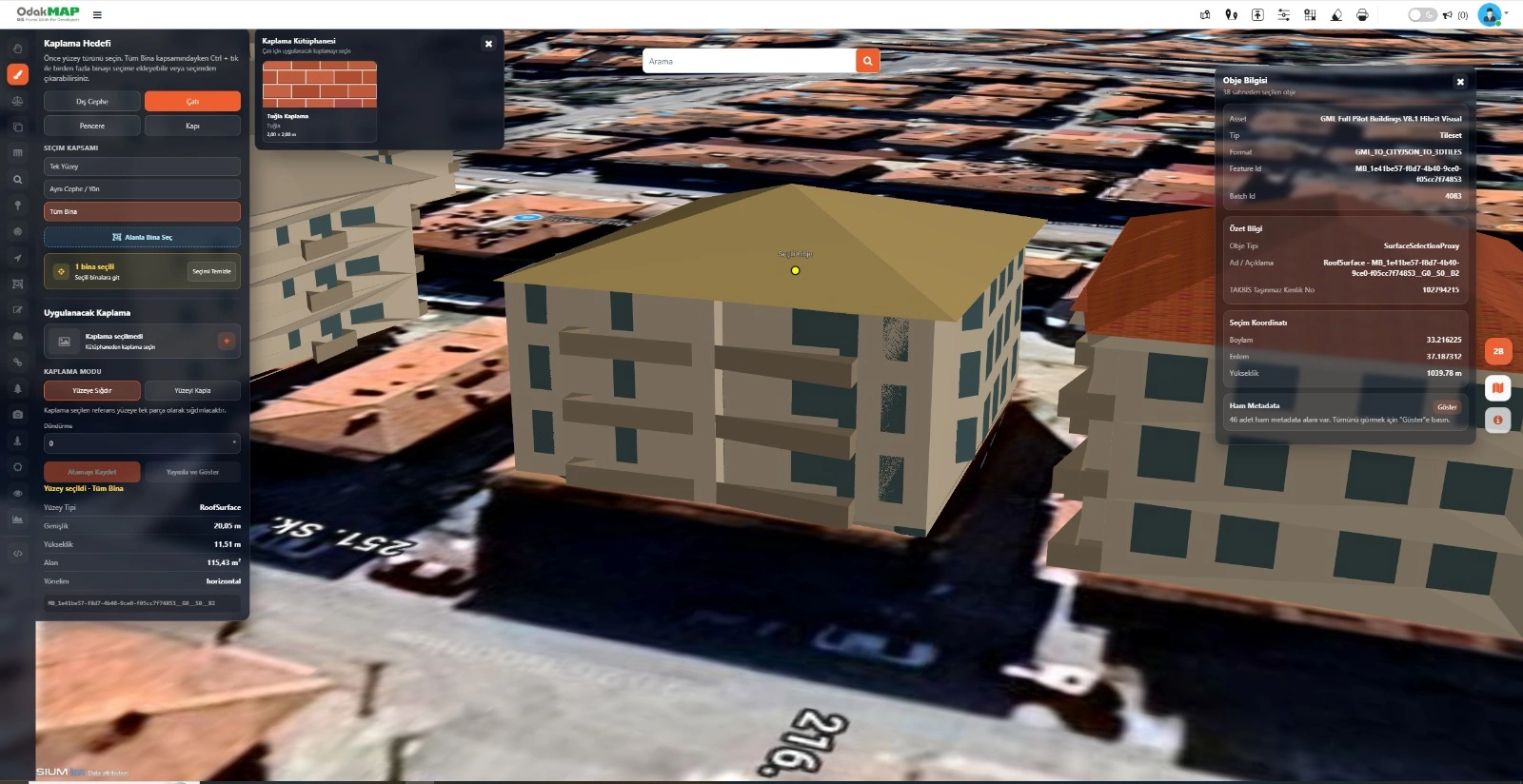
Select a roof, facade, window, or door surface and assign a material from the texture library.
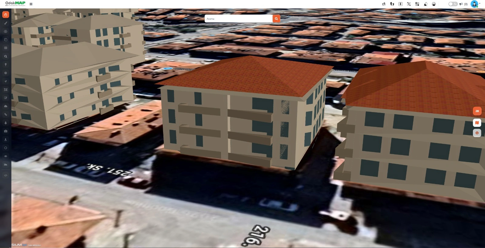
View the selected roof texture on the 3D building model in real time.
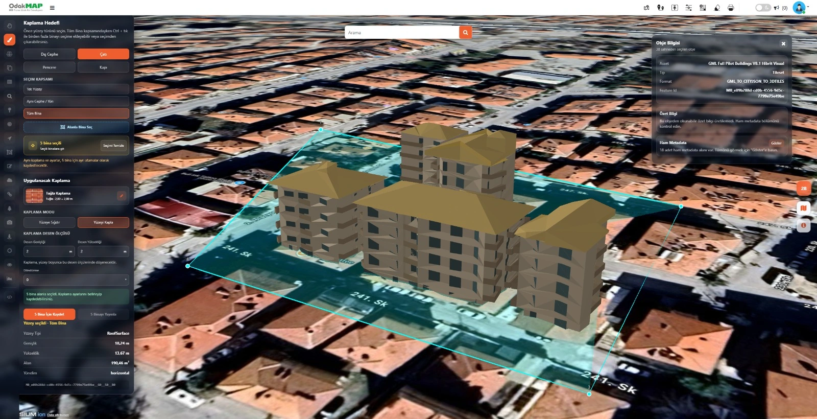
Select multiple buildings by area and apply a shared texture to them in bulk.
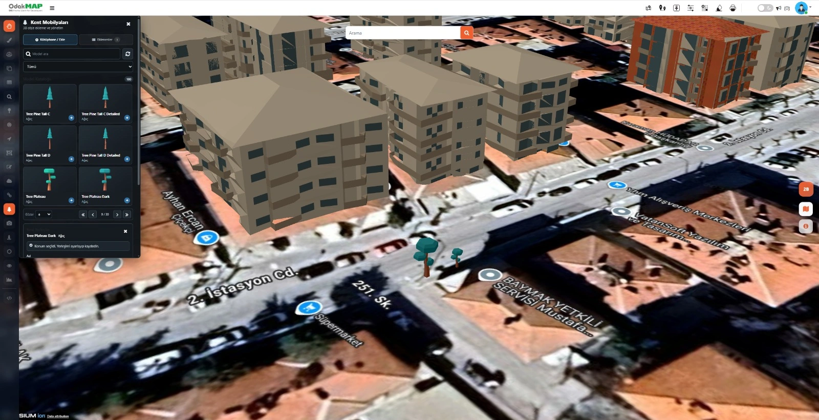
Place trees and other street-furniture objects from the model library at the desired 3D map location.
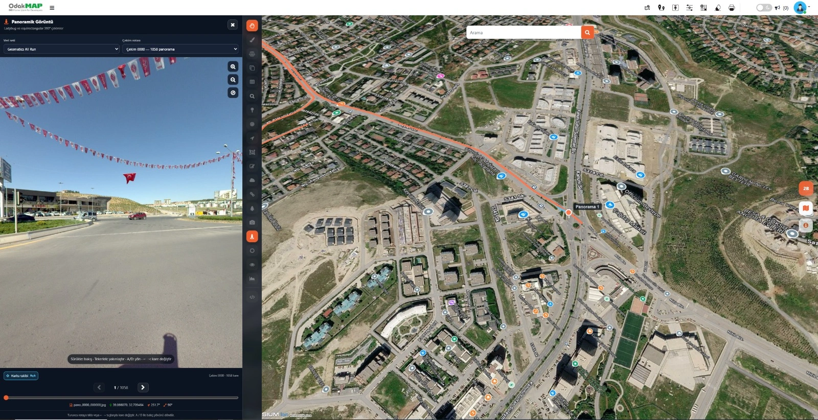
Select a dataset and capture route to inspect panoramic imagery alongside its map location.
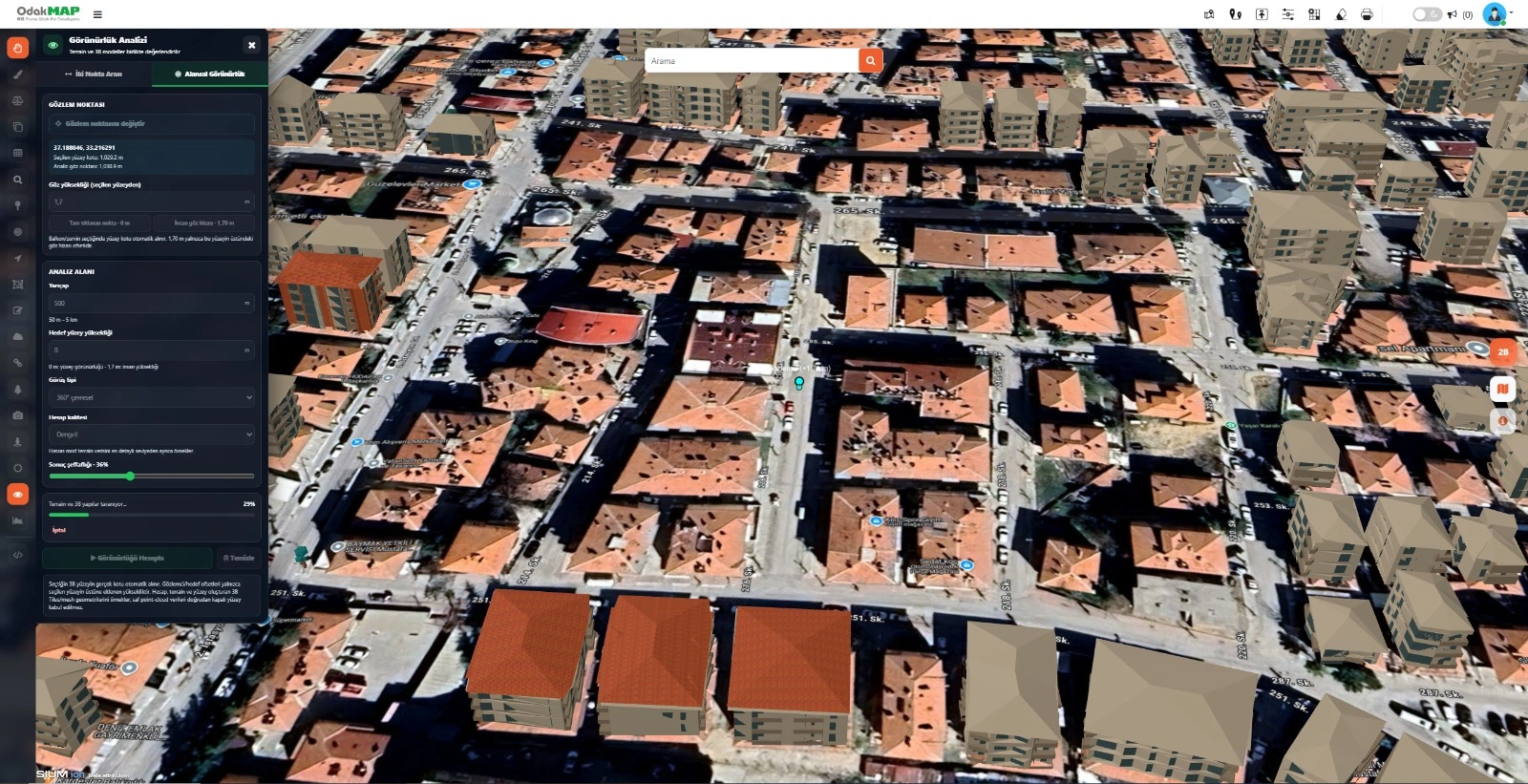
Prepare the analysis area by defining the observation point, eye height, radius, and field of view.
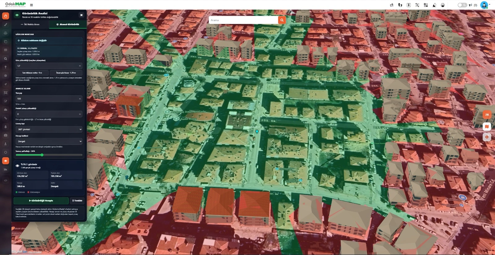
Distinguish visible and non-visible areas on the 3D map using green and red overlays.
FAQ
THE OPERATIONAL 3D ERA
Manage 2D and 3D data in a single structure with OdakTwin and run your processes in three dimensions.